


Hiking itinerary
-
Distance 6km
-
Change in altitude (uphill) 433m
-
Departure La Chapelle-Saint-Maurice
-
Duration 03h00
- Maximum altitude 1430m
Opening period
From 23/04 to 01/11.
Subject to favorable snow and weather conditions.
Description
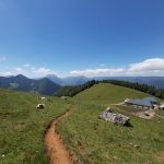
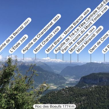
Between Haute-Savoie and Savoie, the path that leads to the Sollier chalets is mostly shaded, the second part is very clear to enjoy a remarkable and very wide view of the Bauges massif
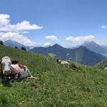
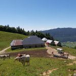
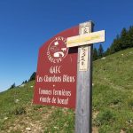
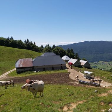
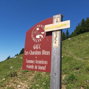
In summer, the herds are in the mountain pastures and the Chardons Bleus farm makes 100% farmhouse Tomme de Savoie cheese on the spot!
Round trip of 433 metres of difference in altitude over less than 3 kilometres, some slippery and slightly steep sections!
How to get there:
- At the exit of the village of La Chapelle Saint-Maurice turn left onto the Chemin de la Cudraz, walk past the farm to the end of the road, after a few metres on a gravel path, park on a wide bend.
Some recommendations:
- This hike should be undertaken in dry weather, from May to the first snow.
- Bring good hiking shoes and walking sticks if possible, the descent is sometimes more difficult than the ascent, it is sometimes slippery!
- Bring water (beware: the water at the Sollier chalets is not fit for human consumption)
- Please stay on the paths and do not cut through the mountain pastures or pick up flowers (private property reserved for the herds)
- Close all enclosures behind you
Have a good walk!
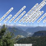
It is possible, if you wish, to continue towards the Roc des Bœufs, but beware that the ascent is difficult and above all the arrival is vertiginous.
Facilities
- Hiking itinerary
Services
- Pets welcome
Price
Free access.
- Route de la Cudraz
- 74410 La Chapelle-Saint-Maurice
Find this route on your smartphone thanks to our ViAnnecy application.
Find this route on our ViAnnecy application