


Hiking itinerary
-
Distance 6.8km
-
Change in altitude (uphill) 382m
-
Departure Duingt
-
Duration 03h00
-
Difficulty Medium
- Maximum altitude 766m
Opening period
All year round.
Subject to favorable snow and weather conditions.
Description
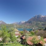
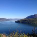
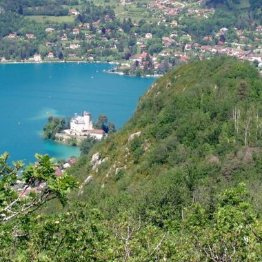
This path is probably one of the easiest and most beautiful hikes of the area, perfectly suited for casual hikers.
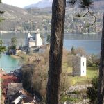
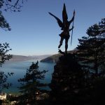
You will discover many astonishing viewpoints on the surrounding lakes and mountains, while learning about history and fascinating anecdotes.
The first part, with a tarmac road, leads you to a viewpoint after a ten minutes walk. The path has many benches and is easily accessible to everyone.
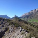
The second part which leads to the plateau and a crossroad for a shorter hike, is accessible for 10-12 years old children, and also has benches to take a break and gaze upon the landscape.
The last part, including the way back, is more difficult, with a few parts were the path is made of rocks, but it is no dangerous (for the kids with experience)
We advise you not to do this hike after heavy rains and to wear hiking shoes. Bring water, some food to picnic or have a quick snack, a windcheater as well as a pair of binoculars and a camera.
Documents
Facilities
- Hiking itinerary
Services
- Pets welcome
Price
Free access.
- Parking de l'église
- Parking route des Prés Bernard
- 74410 Duingt
Find this route on your smartphone thanks to our ViAnnecy application.
Find this route on our ViAnnecy application