


Hiking itinerary
-
Distance 13.7km
-
Change in altitude (uphill) 324m
-
Departure Héry-sur-Alby
-
Duration 03h00
-
Difficulty Very easy
- Maximum altitude 701m
Opening period
All year round.
Subject to favorable snow and weather conditions.
Description
Very pretty bucolic stroll in the Savoyard region on the lands of the Albanais between lakes and mountains of the Alps and Jura!
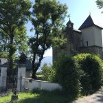
You will cross landscapes borrowed from sweets, plateaus perched at an altitude of 700 meters, a castle, and the charming villages of Héry sur Alby and Chainaz les Frasses. A great discovery away from the busy trails of the Lake Annecy region!
Useful information :
- Parking: Church - Town Hall
- Public toilets: school path behind the town hall
- Several sections of country road with little traffic
- 4 seasons hike:
* but be careful after heavy rain, the path is slippery
* hunting: The path is accessible from mid-September to the end of January on Wednesdays and Fridays only
- accessible to mountain biking on a good part of the trail - circuit n ° 7 / Albanian
- remember to take water and a snack
Let yourself be tempted by this new getaway in Albanais!
Facilities
- Hiking itinerary
Services
- Pets welcome
Price
Free access.
- Chemin des écoliers
- 74540 Héry-sur-Alby
Find this route on your smartphone thanks to our ViAnnecy application.
Find this route on our ViAnnecy application