


Hiking itinerary
-
Distance 7.9km
-
Change in altitude (uphill) 234m
-
Departure Fillière
-
Duration 02h30
-
Difficulty Very easy
- Maximum altitude 1448m
Opening period
All year round.
Subject to favorable snow and weather conditions.
Description
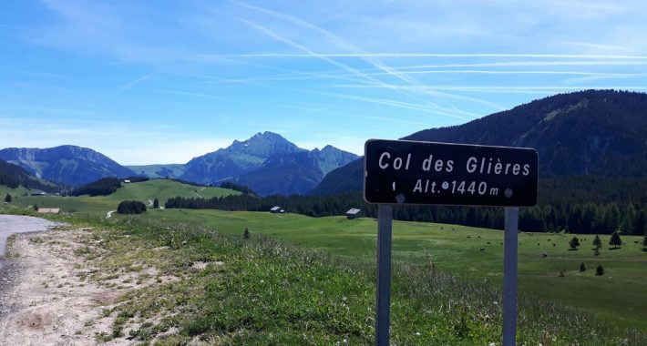
This easy and interesting walk will make you discover the history and the landscapes of the Plateau des Glières, at an altitude of 1500 m, inside the Bornes Massif (34km from Annecy).
This used to be a major place for the French Resistance in Haute-Savoie. "Here, men died to stay men..." But it is also a special site for pastoral agriculture.
The first part of this trip follows a broad rocky path, defined by signs which tell you more about the history of the members of the Resistance, the "maquisards". During the second part, a trail winding through the forest leads to the historical landmarks of the Plateau des Glières.
If you do no wish to picnic, you can taste the specialities of Savoie in several typical mountain restaurants.
Do not forget to pick your camera, because you will discover many beautiful panoramas.
Facilities
- Hiking itinerary
Services
- Pets welcome
Price
Free access.
- Route des Glières
- Thorens-Glières
- 74570 Fillière
Find this route on your smartphone thanks to our ViAnnecy application.
Find this route on our ViAnnecy application