


Hiking itinerary
-
Distance 9km
-
Change in altitude (uphill) 660m
-
Departure Talloires-Montmin
-
Duration 04h30
-
Difficulty Hard
- Maximum altitude 1806m
Opening period
All year round.
Subject to favorable snow and weather conditions.
Description
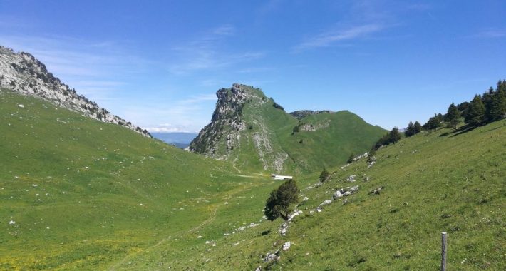
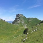
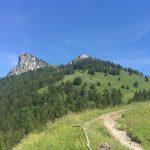
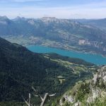
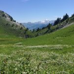
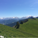
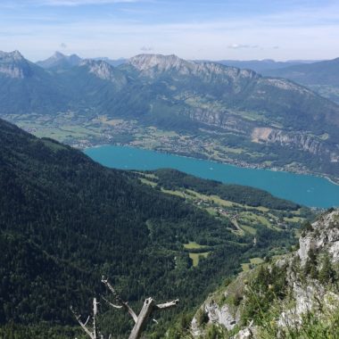
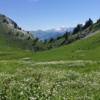
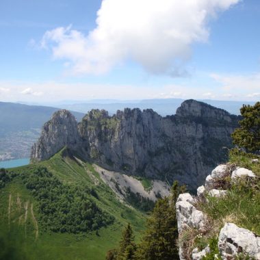
Beautiful hike offering magnificent views of the Tournette, the Aravis, the Mont Blanc crystalline massif and beautiful views of Lake Annecy.
You have the choice of two car parks, the first at the Col de l'Aulp and if you are reckless you can continue on a track to the chalet de l' Aulp.
We begin this route with a descent into the forest, then a nice climb to the Pas de l'Aulp and the Roc de l'Ancrenaz to arrive on a beautiful alpine valley, a nice relaxing crossing before climbing again towards the goal Ultimate Talamarche where a 360 degree panorama awaits you. We recommend this walk for people who want to enjoy beautiful views to Mont Blanc and the lake
Our advices :
- To do with children trained to walk
- Walking sticks - water - picnic - binoculars (ibex)
- Do not pick the flowers and bring back your waste, even the paper handkerchiefs
- Keep the dog on a leash (presence of herds and wild animals)
- Restaurant and bar in summer: Chalet de l'Aulp (Savoyard specialty) and reblochon sale.
Facilities
- Hiking itinerary
Services
- Pets welcome
Price
Free access.
- Chemin du Col de l'Aulp
- Montmin
- 74210 Talloires-Montmin
Find this route on your smartphone thanks to our ViAnnecy application.
Find this route on our ViAnnecy application